Stats
Day 20 feb 16 0 miles, rest and restock day, Baton Rouge
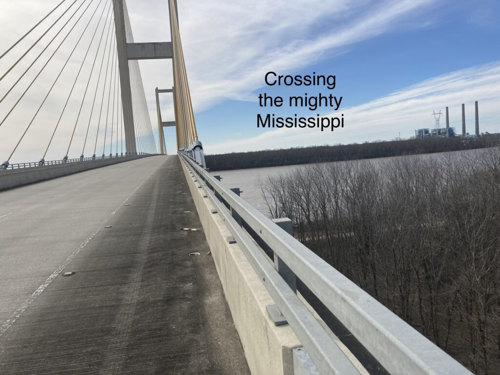
Day 21 feb 17. 46 miles, 15 mph headwind first 42 miles. Hard. End in New Roads LA
Running total 875
Well, I’m west of the Mississippi. Today was only 46 miles but the first 42 were into a steady 15 mph headwind. I find I can only make about 7.5 miles per hour with that even while working hard. Also, the wind was cold. The temp when I left Baton Rouge was only 41 F, and with that wind the cold penetrated my clothing. I just took a very hot shower to warm up. Wasn’t it just two days ago that I was too hot?
A couple of you asked about how I navigate, so I thought I’d discuss that here today.
When I sailed out of England to cross the Atlantic the old timers reminded me of the classic mariners way to get to the Caribbean.
Their navigation instructions were:
“Sail south till the butter melts. Turn right”
Equivalent for this biking route:
“ Keep the sun behind you in the morning and to the left during midday, stopping when it gets in front of you till you see the Pacific Ocean.”
I could have followed the old timers recommendations and made it across the Atlantic, just like I can follow the biking equivalent and find the Pacific Ocean, but for some reason weS humans (Fred Sharpe PhD, the whale expert, thinks that the whales think of us as “ gadgeteers”) do like our gadgets.
As simple as it was in the days before GPS was available in my crossing of the Atlantic, I still had a sextant, a tracing of Prickley Bay in Grenada, and a map of the world, showing the Atlantic Ocean only about three inches wide. Once you leave the Canary Islands (turn right) there’s nothing to hit until you see Grenada.
Any amateur can use a sextant to find latitude and then continue to sail that latitude till you find your destination. Your latitude is the zenith height of the sun subtracted from ninety degrees and adjusting for the seasonal declination ( time of year). In an emergency you could do it using a pencil or even your fingers to get pretty close.
And, if it’s cloudy for a few days in a row, well, I was only shipwrecked once. ( that’s a longer story that some of you know)
Nowadays we are used to seeing our blue dot on an electronic chart, either on a chart plotter or even our phone. There is no excitement when an island shows up right where you expect it.
When Grenada showed up where I expected it I thought it nothing short of a miracle!
Now, What do I do since I forgot my sextant?
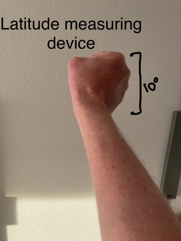
If I go out at night and find Polaris ( North Star), extend my arm while making a fist and count how many fists added together ( at ten degrees each) from the horizon to Polaris I also have my latitude.
Ok, remember that if you find yourself in a life raft or want bore someone at a dinner party.
So I can just pedal west, go out making a fist every clear night till I get just over three fists and one finger of height and I’m at San Diego’s latitude. (32.7 degrees north)
Reality on this bike trip:
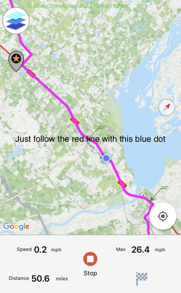
I have an app from Adventure Cycling ( ACA) to follow my route in real time on my iPhone
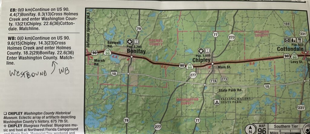
I have a set of paper maps from ACA, showing each turn
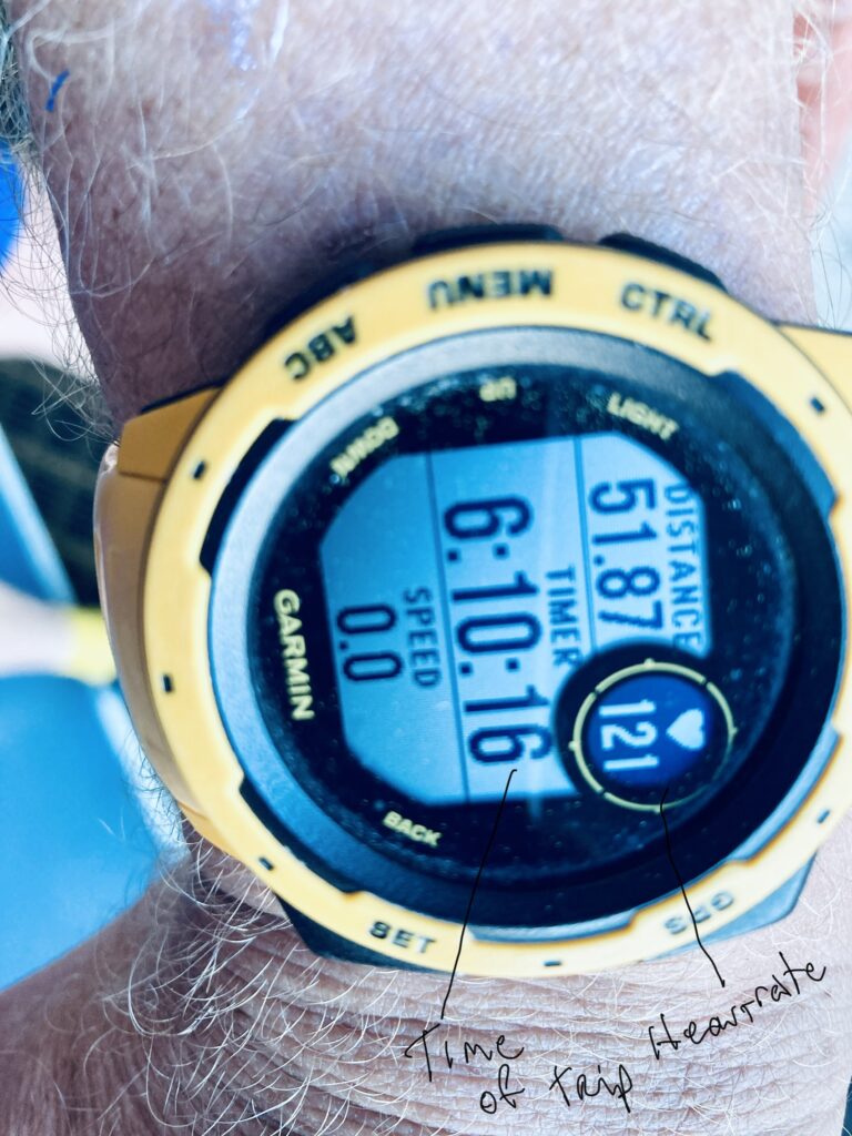
I have a Garmin instinct watch that shows: time of travel, distance travelled, speed and heart rate.
I have a fist at the end of my outstretched arm aiming at Polaris in the night sky.
Using all these I intend to find San Diego.
Maybe I have too much time on my hands to think about this?